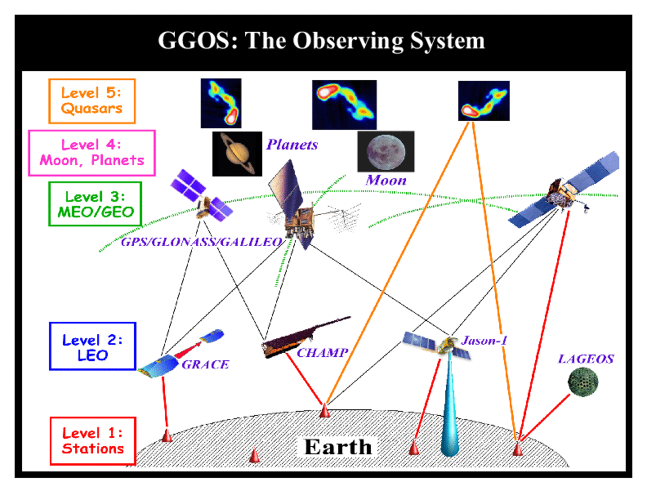
The observing infrastructure can be considered as a layered system with five main layers:
- Level 1: the terrestrial geodetic infrastructure;
- Level 2: the LEO satellite missions;
- Level 3: the GNSS and the Lageos-type SLR satellites;
- Level 4: the planetary missions and geodetic infrastructure on Moon and planets;
- Level 5: the extragalactic objects.
These five levels of instrumentation and objects, independent of whether they are active or passive, receivers or emitters or both, are connected by many types of observations in a rather complex way to form the integrated GGOS observing system. In this system, the major observation types at present are:
- observations of the microwaves emitted by GNSS satellites at the ground and at the LEO satellites;
- laser ranging to LEOs, dedicated laser ranging satellites, GNSS satellites and the Moon;
- microwave observation of extragalactical objects (quasars) by VLBI;
- instrumentation onboard the LEO satellites measuring accelerations, gravity gradients, satellite orientation, etc.;
- radar and optical observations of the Earth's surface (land, ice, glaciers, sea level, ect.) from remote sensing satellite;
- distance measurements between satellites (K-band, optical, interferometry, etc.).