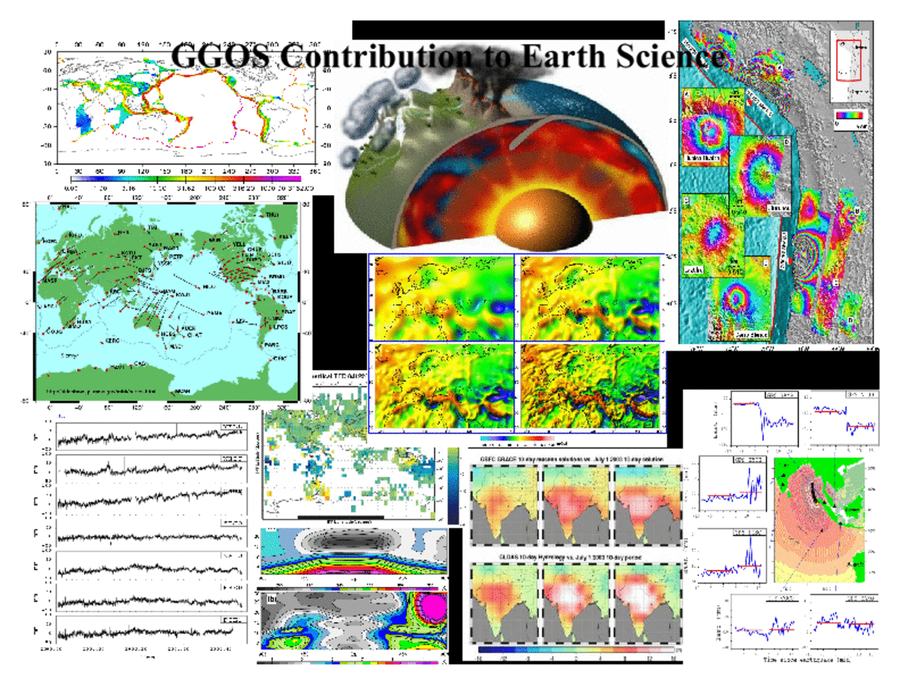
There is a wide range of contributions GGOS provides or supports in service of Earth science. The slide illustrates just a few examples. Almost all geodynamic processes are associated with changes in Earth's shape, gravity field and rotation. Consequently, geodetic observations provide the basis for ever improving understanding of these processes. The geodetic tracking networks provided novel measurements of Earth's surface kinematic, and they allowed the determination of a global strain map. Time series of point displacements derived from, in particular, GPS have revolutionized our understanding of how pre-, co- and postseismic deformation takes place. Geodetic imaging techniques provide a detailed picture of surface displacement and have greatly improved our understanding of the processes associated with volcanoes, earthquakes, landslides, and subsidence. Gravity satellite missions not only have resulted in orders-of-magnitude improvements of the gravity field model but also for the first time ever provided an integral picture of changes in land water at subcontinental scales. Geodetic sounding of atmosphere and ionosphere provides important observational input for meteorological models, and real-time determination of surface displacements during earthquakes have the potential to support early warning systems.